Menu


We developed and implemented the content and designed the stands and signposts for the route.
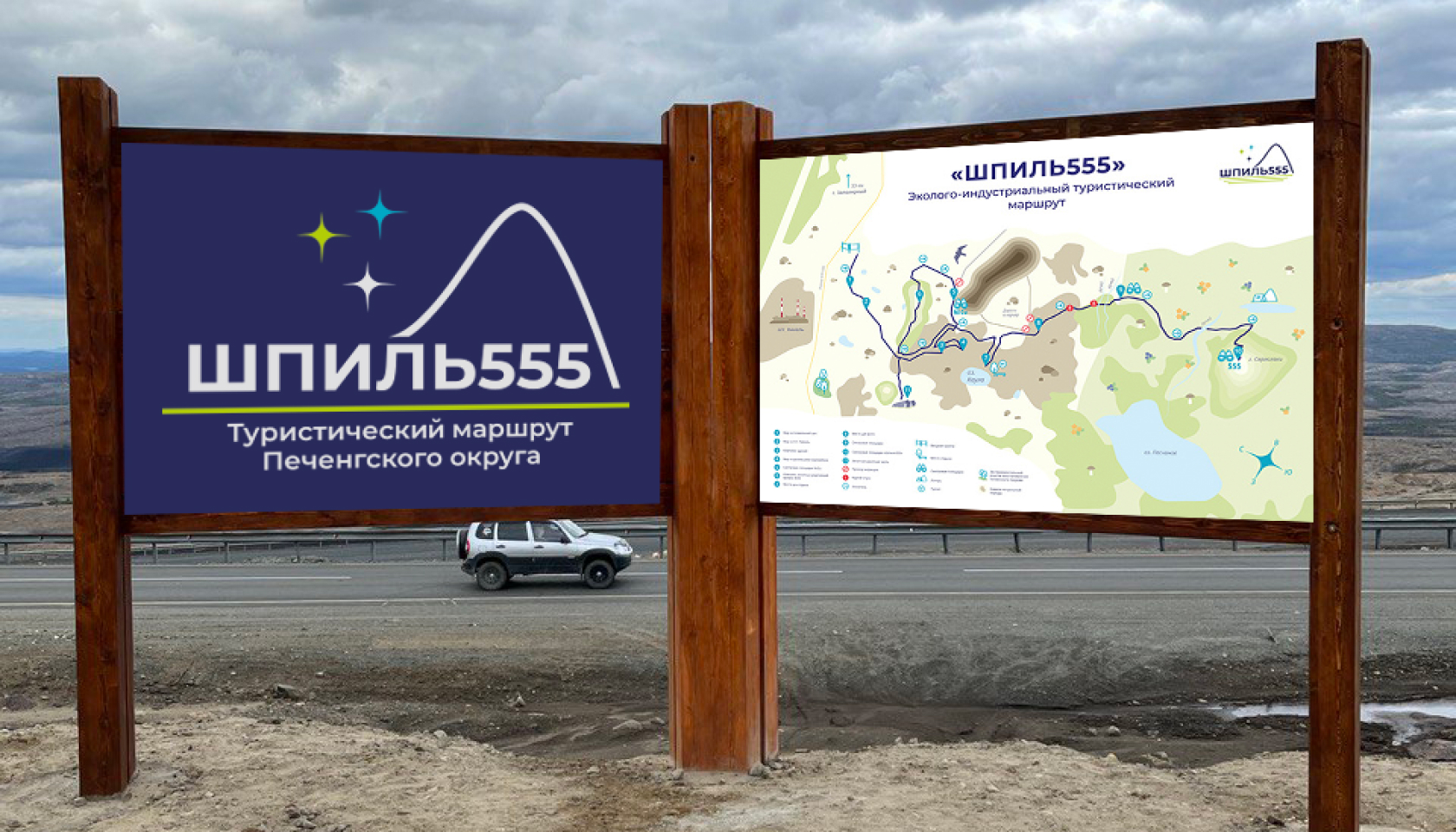
Eco-industrial tourist route “Shpil555”
The eco-industrial route "Shpil555" is the first part in the creation of a tourism cluster under the Nickel-Tourism-2025 program.
ABOUT THE ROUTE
Our clients are the creators and executors of the "Tourist Routes" project of the Pechengsky district. The project was organized by the ANO "Center for Social Projects "Second School" with the financial support from Nornickel.
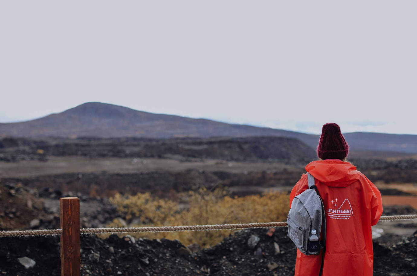
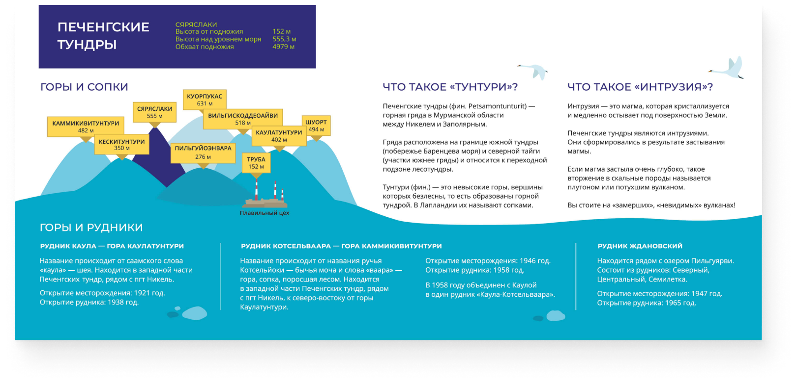
The route "Shpil555" is laid through the territory, whose history is connected with the development of the Kaula deposit, where nickel and copper were mined throughout the 20th century, where the city of Zapolyarny was founded, and an enrichment plant and a smelting shop were opened.

ABOUT THE ROUTE
Our clients are the creators and executors of the "Tourist Routes" project of the Pechengsky district. The project was organized by the ANO "Center for Social Projects "Second School" with the financial support from Nornickel.
The route "Shpil555" is laid through the territory, whose history is connected with the development of the Kaula deposit, where nickel and copper were mined throughout the 20th century, where the city of Zapolyarny was founded, and an enrichment plant and a smelting shop were opened.

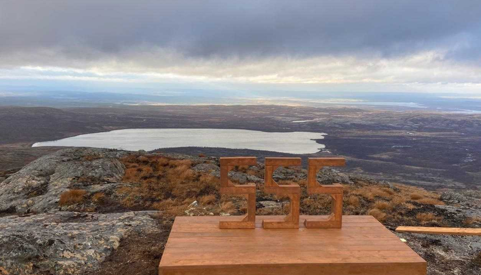
The route shows the history of the quarry and its development, leading to the final point — the observation deck at the top of Mount Säräslaki. It is commonly referred to as "Spire". The height above sea level is 555 meters, hence the name of the route itself — "Shpil555"
TASK
The representatives of tourist routes of the Pechengsky district contacted us to develop all the necessary stands and signs for the route.

Short and pressed deadlines as well as lack of text information for the stands.
Particulars of the job

To present the industrial and natural heritage of the region within the framework of a system of signs on one route in a concise, vivid and clear way.
Key job
The route shows the history of the quarry and its development, leading to the final point — the observation deck at the top of Mount Säräslaki. It is commonly referred to as "Spire". The height above sea level is 555 meters, hence the name of the route itself — "Shpil555"

TASK
The representatives of tourist routes of the Pechengsky district contacted us to develop all the necessary stands and signs for the route.

Short and pressed deadlines as well as lack of text information for the stands.
Particulars of the job

To present the industrial and natural heritage of the region within the framework of a system of signs on one route in a concise, vivid and clear way.
Key job
WHAT WE ACCOMPLISHED
Prepared brief information about the key points of the route based on the materials provided.

Developed the design of information boards and signpost systems.
Created a series of illustrations: maps, diagrams and the main objects along the route.
Content
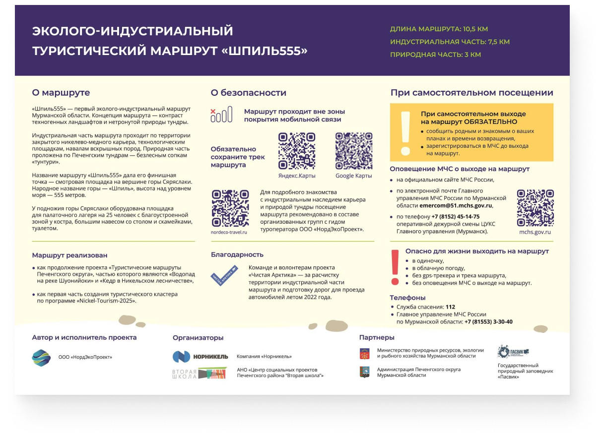
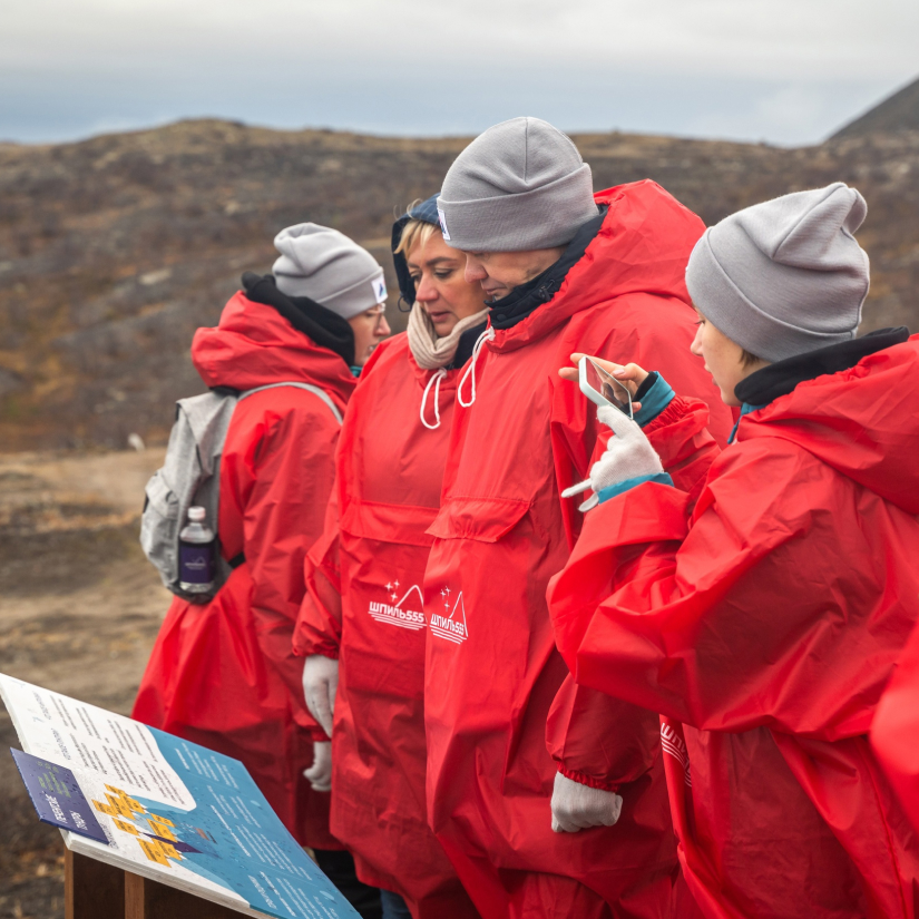
The difficulty of the task was to provide all the necessary information for visitors within just four information stands.

Talk about safety as clearly as possible.

Highlight the features of the landscape of the Pechenga tundra mountain range.

Introduce the history of the quarry and show the importance of nickel and copper mining.

Talk about the nature of Mount Säräslaki.
To create information stands, we did a lot of joint work with the team of the eco-industrial route.

#rec662118175
#rec662118176
#rec662118177
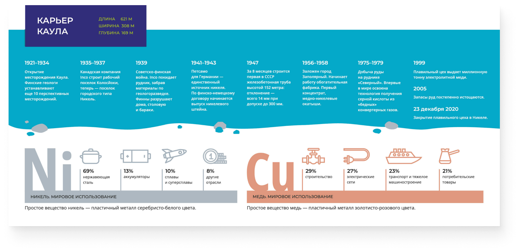


We decided to introduce the history of the quarry using a timeline with key dates.
It turned out to be difficult to select the most important events: during the 1935−1945 period alone, the quarry ended up under the possession of different countries several times and survived two wars.
Here we also included the information about the importance of nickel and copper mining.

An infographic dedicated to the global use of these metals in various industries helped us do this in an accessible and concise manner.
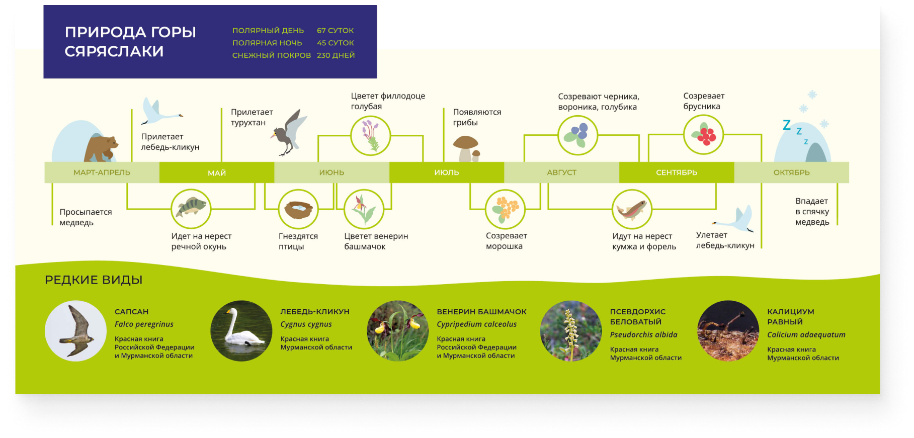
The theme of nature was revealed through a visual representation of seasonal natural processes.


Through the infographics, we were able to depict the cyclical occurrences of the Pechenga tundra, which can be observed there from March to October: from the emergence of the bear from hibernation to the spawning of fish, the arrival of birds, the blooming of plants to the ripening of berries, and the bear going into hibernation.
The picture was completed by rare species of plants, animals and lichens typical of the Pechenga tundra.
The picture was completed by rare species of plants, animals and lichens typical of the Pechenga tundra.
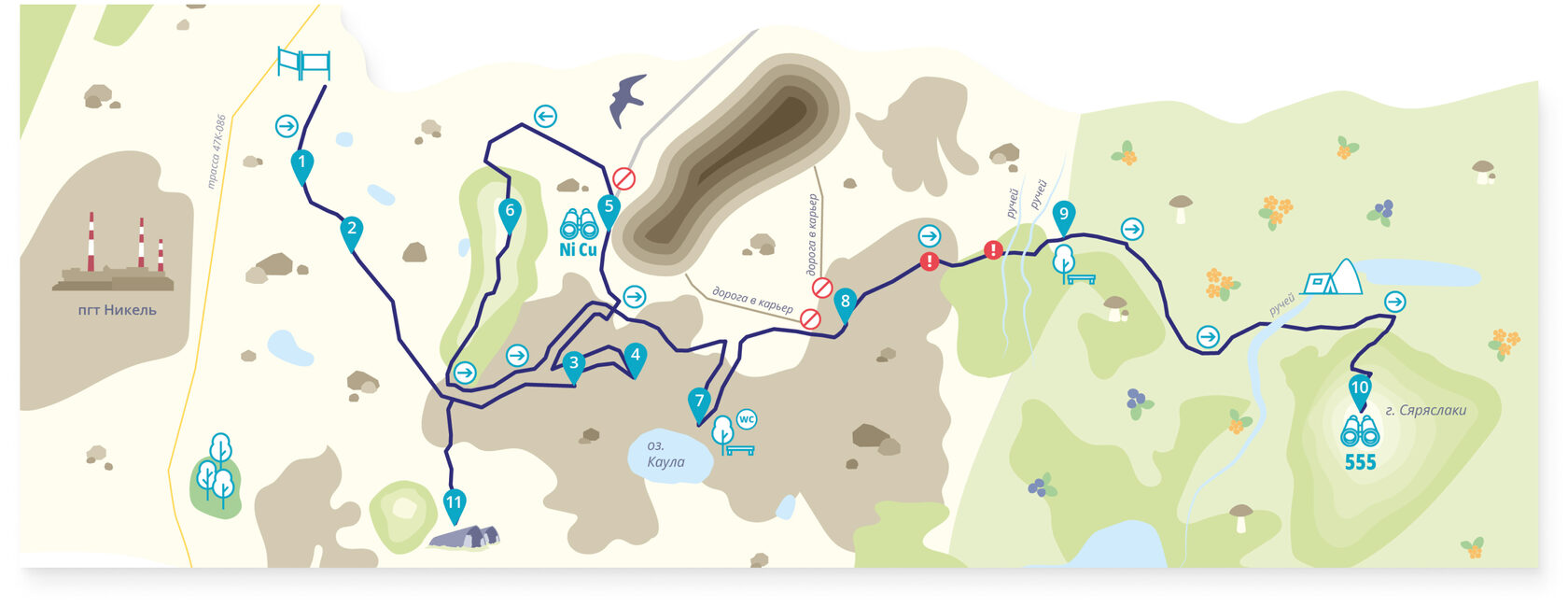
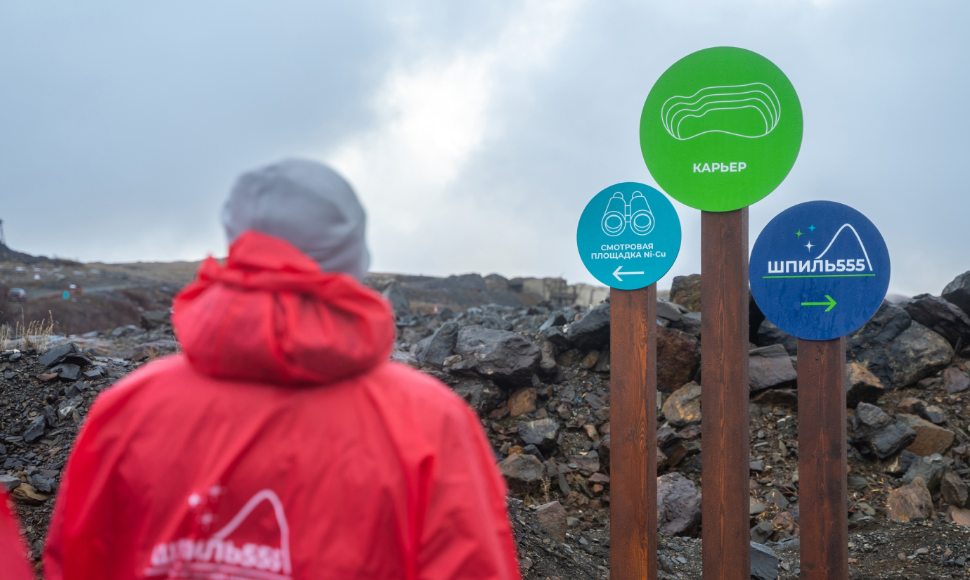
You can navigate the route using two types of signposts: dot stands and arrow signs.
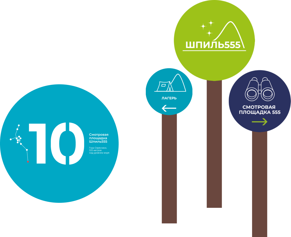

You can navigate the route using two types of signposts: dot stands and arrow signs.

Design
We were faced with the task of developing a design that would make it easy to navigate the route on cloudy days, in foggy conditions and the harsh landscapes of the quarry and tundra taken into account.
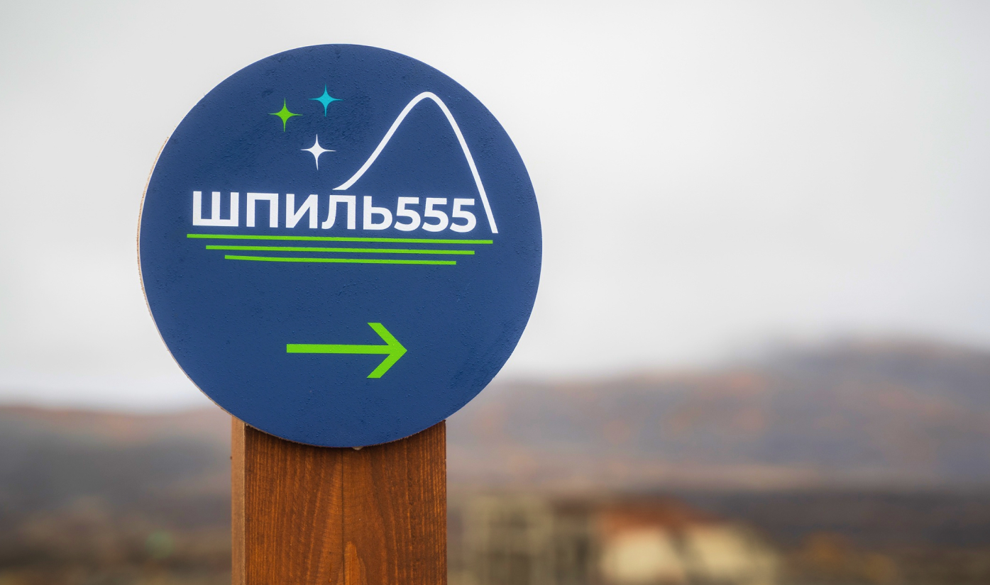
The corporate style of the tourist routes of the Pechenga district provided the basis for the design concept. It determined the color scheme of the dot stands, signposts and information stands.
All stands were united by concise graphics of the route line and symbols: quarry, observation decks, missile unit, etc.
We made the dot stands and signs bright so that they were clearly visible even in poor weather conditions. The main shades in the design were bright turquoise, the color of fresh grass and deep berry blue. We chose a contrasting white color for the text.
Illustrations
For the dot stands, our designers came up with a minimalist drawing of the route, which helps everyone who walks it to find their way, and at the same time looks like a graphic pattern serving as a decoration for the signpost.

For the signposts, the designers created a series of illustrations depicting the objects which a particular stand is dedicated to: a rest stop, an observation deck, a quarry, and a camp.

For the entrance group specifically, we drew a map of the entire route with images of key objects on it.
The map also shows the eco-industrial manner of the track: it is easy to navigate and understand that the trail includes both man-made objects and areas of untouched nature.

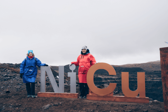
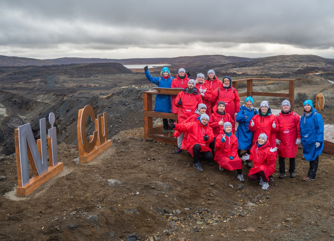
Nickel and copper mining was carried out at the Kaula quarry throughout the whole 20th century. Now that the quarry is closed, you can look at it from a specially equipped observation deck.
To make the deck clearly visible to every visitor of the route, we developed a separate stand for it called Ni-Cu. Not only does it serve as an excellent landmark, but it also makes an attractive site for a photo shoot with an industrial landscape as background.
To make the deck clearly visible to every visitor of the route, we developed a separate stand for it called Ni-Cu. Not only does it serve as an excellent landmark, but it also makes an attractive site for a photo shoot with an industrial landscape as background.

For the quarry stand, the designers created drawings depicting the main areas where nickel and copper mined at the quarry are used practically.


The stand about nature was accompanied by drawings with the main characters of the seasonal processes occurring in the tundra from March to October: bear, whooper swan, ruff bird, river perch, lady’s slipper orchid, lingonberry and others.


RESULT
The "Shpil555" route is open, has welcomed its first visitors, and is waiting for new guests, to show them that the harmonious vicinity of post-industrial landscapes and untouched nature can become an important point of attraction for both industrial and ecological tourism.

Project team
Les
Anna Sapelnikova
Project Manager
Project Manager
Anastasia Vasilchenko
Art director
Art director
Sofia Kozhanova
Coordinator
Coordinator
Tatiana Denisova
Editor
Editor
Natalia Kalashnikova
Lead designer
Lead designer
Ekaterina Yurchak
Graphic designer
Graphic designer
Victoria Makarchuk
Graphic designer
Graphic designer
Tourist routes of the Pechengsky district.
Aleksandra Bogdanova
Project creator and executor
Project creator and executor
Natalia Polikarpova
Pasvik Nature Reserve director, project expert
Pasvik Nature Reserve director, project expert

Leave a request
By clicking the button you agree to the Privacy Policy
OTHER PROJECTS

© Les Agency

